Building date: Built and razed dates unknown. Walls collapsed due to decay and lack of maintaining the cobblestone structure, the stones were crushed and used for highways.
Original use: Barn
Corner structures:
Mortar application and content:
Types and uses of stones:
Types and choice of windows:
Structures with similar masonry details:
Masons who worked on building:
Unique features:
Map views courtesy Google Maps. Address is Google Earth confirmed; 43°01'51.93"N 77°19'59.09"W.
Town of Farmington and Ontario County Maps
This was the old cobblestone barn once located in the Pumpkin Hook area. It sat to the left of the current St. John Lutheran church on Church Avenue. It was a two-story building and was divided into four sections or "apartments." It is believed it was the only cobblestone building in Ontario County used for business purposes. Over the years it housed many different types of businesses for: a wagon making, blacksmithing, a restaurant and oyster bar, dry house for apples, a stable for horses and a paint shop. When the walls collapsed due to decay and lack of maintaining the cobblestone structure, the stones were crushed and used for highways. The town has a roadside marker to identify the area but we are unsuccessful in receiving the permission from the current land owner to place the sign. Courtesy Donna Hill-Herendeen, Farmington Town Historian. Richard Palmer blog.
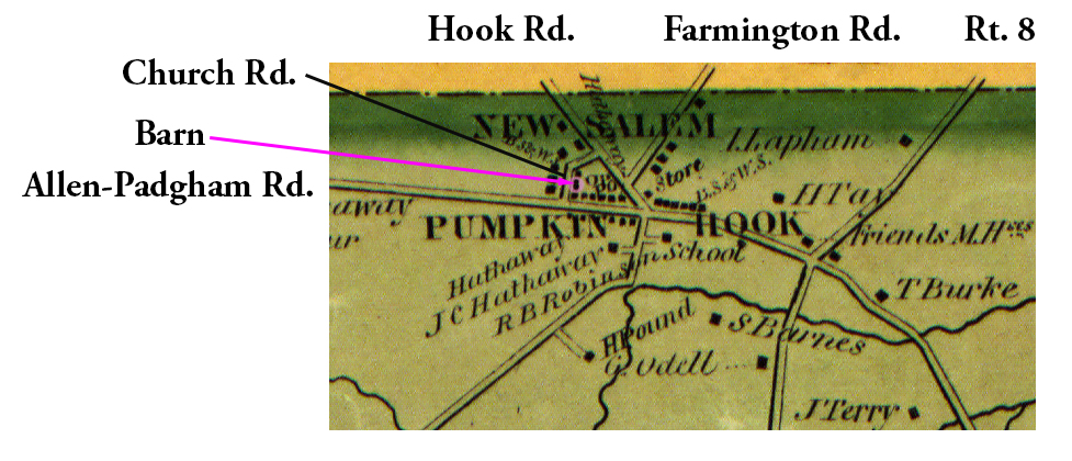 1852 Ontario County Map Far-10 Barn Excerpt ¹ | 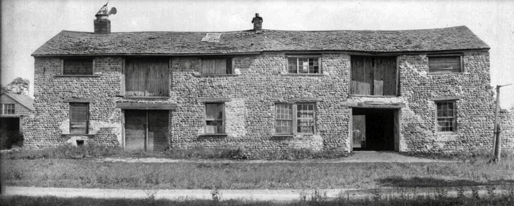 Farmington Barn.jpg ¹ |
¹ 1852 Ontario County Map Far-10 Barn Excerpt courtesy New York Public Library.
² Photography courtesy Richard Palmer.
